“By introducing the Norwegian routes in the services of international chart providers, more mariners will get access to them. That increases the possibility of more mariners using safer and efficient route options, quality-assured by national authorities, when sailing to and from Norwegian ports,” says senior engineer John Morten Klingsheim at the Norwegian Coastal Administration (NCA).
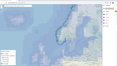
PRIMAR delivers electronic charts from around the world. Today, PRIMAR delivers Norwegian electronic charts to more than 5000 national and international vessels. By including Norwegian sailing routes in PRIMAR's portfolio, the product can be available to even more mariners. Mariners in China, India and Brazil can now easily get digital sailing routes to Norwegian ports from their preferred map provider.
In the future, Klingsheim believes that mariners, who, as an example, sail from New York to Oslo with stops in Rotterdam and London, could use quality-assured routes from different countries during the planning of the entire voyage.
The NCA digital route service, established in 2018, facilitates easier voyage planning and navigation for mariners. Today, this service provides over 500 digital reference routes that are quality-assured by mariners and marine pilots in the Norwegian Coastal Administration. The routes are quality assured for vessels up to 150 metres in length and 9 meters in draught.
A customized service
In a NCA user survey from 2020, 43 per cent of the users of the Norwegian digital route service, www.routeinfo.no, said that the best way to access reference routes for navigation was via map providers. As that would enable mariners to get automatic access to digital routes via well-established bridge systems, such as Electronic Chart Display and Information Systems (ECDIS) or Electronic Chart Systems (ECS).
The integration of digital sailing routes and electronic charts is an e-navigation service. E-navigation is a global strategy that recommends digitized and automated exchange of information between ships and governmental agencies.
Through the digital route service, mariners receive more customized information about their voyage, where both quality-assured routes and route information become much more accessible to a vessel during the entire voyage ‒ from the port of departure to the destination. The overall aim is to contribute to safer and more efficient navigation.
The service provides information on local regulations that apply during the voyage to individual ports, in addition to sailing distances. VHF-channels for the Vessel Traffic Service centres are visible as waypoints along the routes.
"In the long term, the use of digital sailing routes could also give environmental benefits by including information on where mariners can get access to renewable fuel in Norwegian ports, which hopefully could result in less use of fossil fuel," Klingsheim points out.
Uses open source data
The digital route service, routeinfo.no, follows an open data policy. Consequently, making the routes available for commercial services and products.
PRIMAR is proud to be the first to support the route service directly to mariners, and also eventually wants to be able to offer routes from other countries. The Norwegian Coastal Administration has now set the course, making this a possibility in the future. The services we have established show how close and important cooperation across maritime organizations can contribute to safer navigation in Norwegian waters.