The rules take effect on January 1, 2026, and apply to designated areas when the Norwegian Meteorological Institute issues a strong gale warning, meaning an average wind speed of 17.2 m/s (Beaufort 8) or higher.
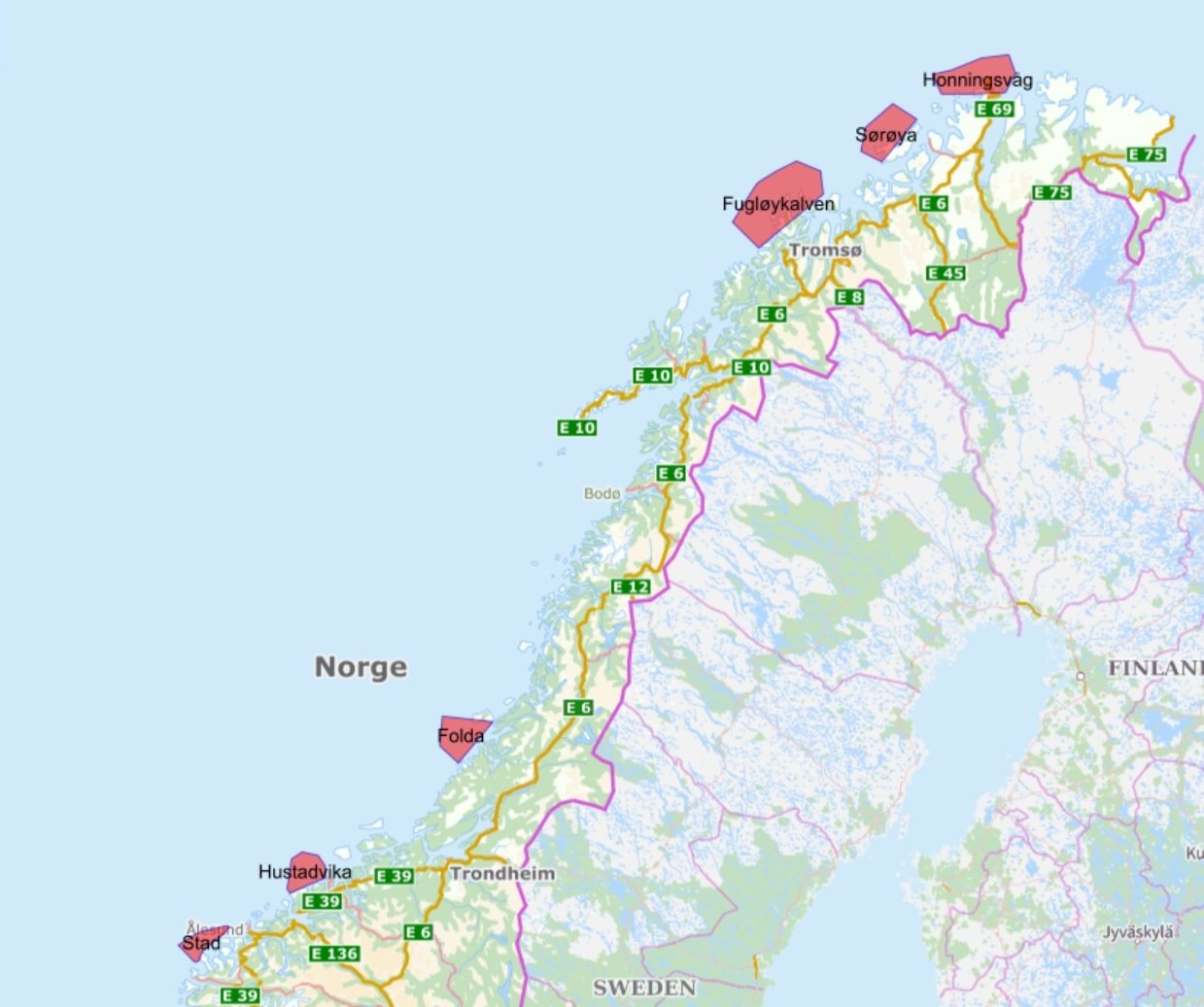
The ban applies to six vulnerable coastal stretches: Stad, Hustadvika, Folda, Fugløykalven, Sørøya, and Honningsvåg. You can find the areas here: https://kystinfo.kystverket.no/sjotrafikkforskrift
Particularly Weather-Exposed
These areas are among the most weather-exposed waters along the Norwegian coast. The new sailing regulations adopted by Kystverket mean that passenger vessels over 150 meters are prohibited from navigating these waters when a strong gale is forecast.
“Large passenger vessels operating in challenging waters pose a risk to emergency preparedness if something goes wrong. The new rules will help reduce risk and ensure that voyages are carried out safely and responsibly,” emphasizes Arve Dimmen, Department Director at Kystverket.
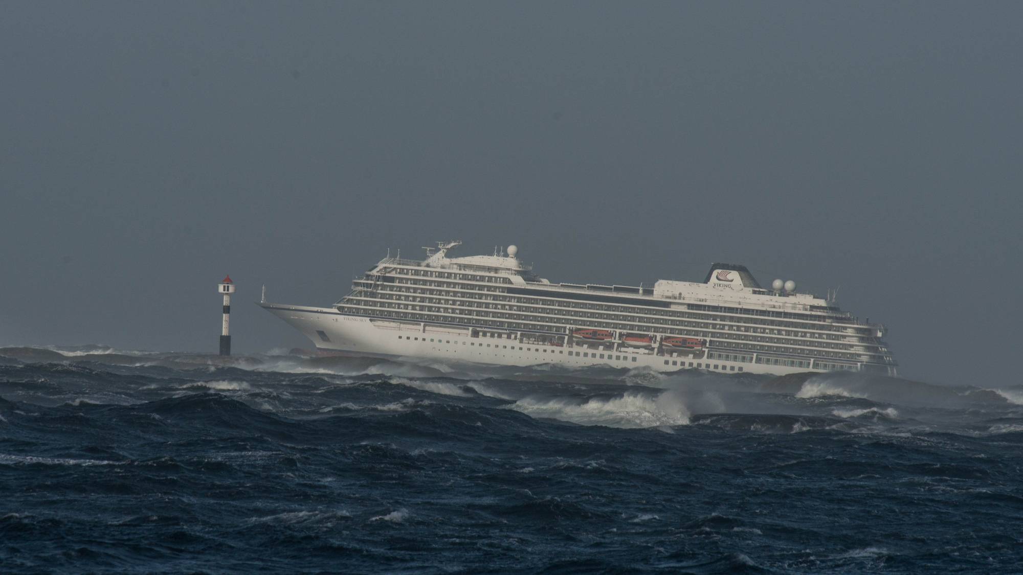
This measure follows a recommendation from NOU 2022:1 “Cruise Traffic in Norwegian Waters and Adjacent Sea Areas” and aims to strengthen safety for large passenger ships in areas where weather conditions can make rescue and emergency operations difficult. The regulation, which has been through public consultation, is one of several measures proposed after the near-accident involving the cruise ship Viking Sky in 2019.
Wind assessments are based on gale and storm warnings from the Meteorological Institute. These warnings cover the entire Norwegian coast and are issued when wind speeds of stiff gale (13.9 m/s) or higher are expected. The format of the warning follows international standards. Warnings are relayed via Coastal Radio, published under hazard warnings on Yr, and posted as text alerts on Met.no.
How Will This Be Managed?
The Vardø Vessel Traffic Service Center will oversee compliance with the rules.
Ships planning to sail through the designated areas must monitor gale and storm warnings from the Meteorological Institute. If the warning for the relevant stretch indicates strong gale or higher, the area will be closed for passage. This means the vessel must reroute or wait for better weather.
A vessel that has already started its voyage in a restricted area will not be required to abort if an updated strong gale warning is issued while it is in the area.
Kystverket will evaluate the navigation ban after it has been in effect for some time and make minor adjustments or changes if necessary.
Kystverket is also preparing guidance for practical implementation of the ban.
Amendment Regulation:
https://lovdata.no/dokument/LTI/forskrift/2025-10-29-2159 (in Norwegian)